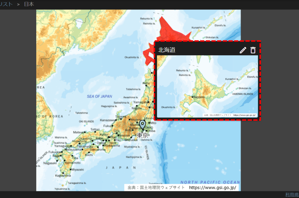
Set up a pop-up to open a subordinate map when clicking on the top map.
Even if you open a map of Japan and click on Hokkaido on the map, you can set up a map of "Hokkaido" to pop up.
You can also click on the map that pops up to open a subordinate map and locate the camera on the map.
メモ
The images are from an integrated video management system, but the basic operation method is the same.
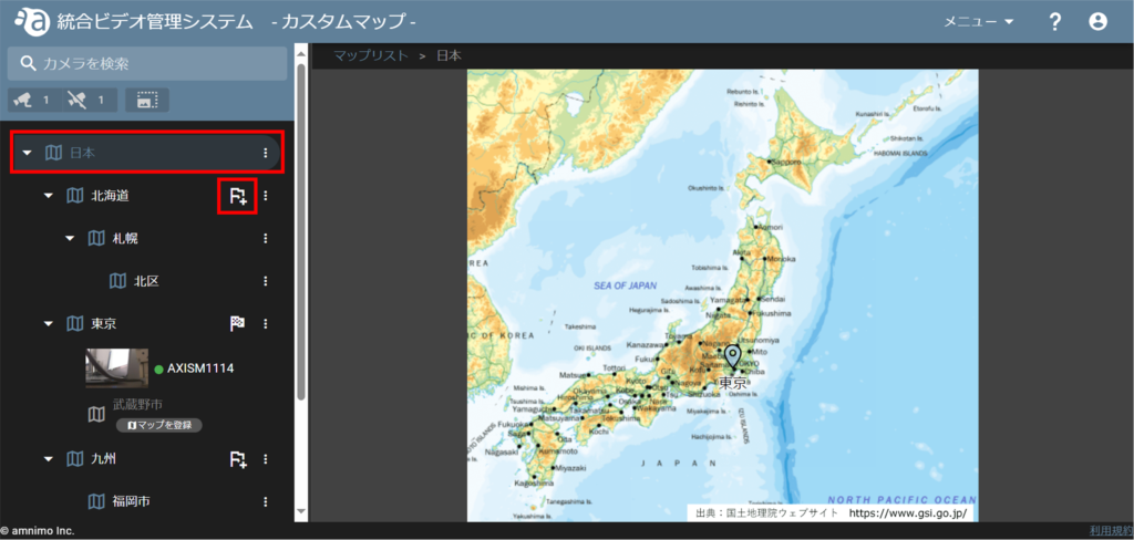
Click on the folder with the upper map, then click on the flag icon of the folder with the lower map.
In this example, click on the flag icon that appears in the Hokkaido folder when you click on the Japan folder.
The Map Object Settings screen will appear. Select "Icon" or "Area" and color as the marker.
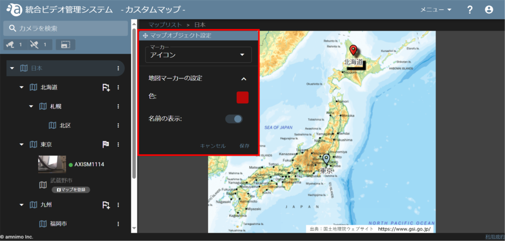
アイコンで設定する
icon to the location of Hokkaido on the map and click [ Save ].
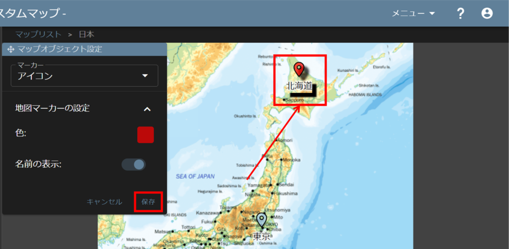
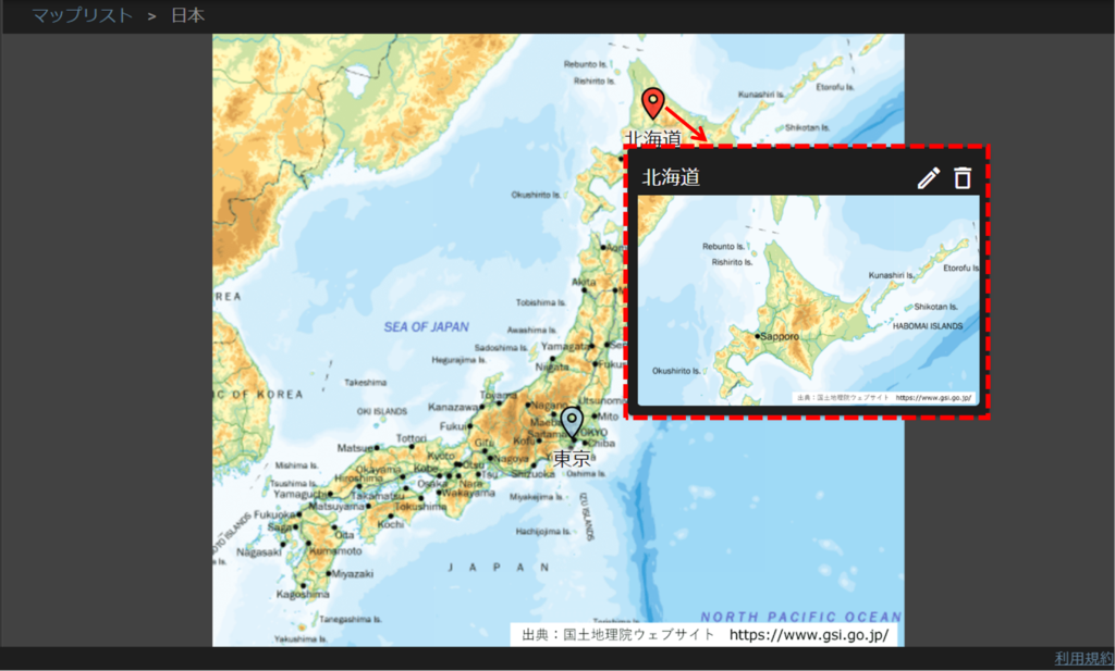
As shown in the figure, a map of Hokkaido will pop up when you hover over the icon.
You can also click on the thumbnail that pops up to open that map.
エリアで設定する
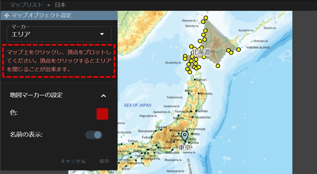
When the message shown in the figure appears, click around the area to form the shape of the area you want to specify.
The maximum number of antlers that can be plotted is 50.
Finally, click again on the starting point to enclose the area, drag to fine-tune it, and click [ Save ].
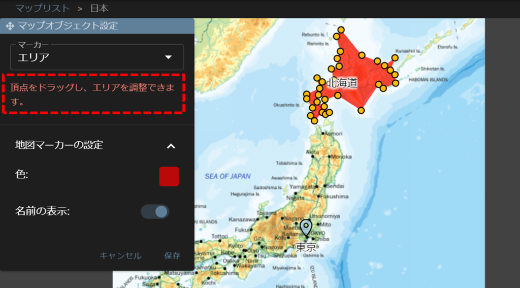
As shown in the figure, a map of Hokkaido will pop up when you hover the cursor over the designated area.
You can also click on the thumbnail that pops up to open that map.
